An Introduction to OBS
The tropical storm Idalia is causing big waves at the location of line one. Thus, we paused recovering OBS from line one, and started to deploy OBS along line two instead. While we are recovering and deploying the OBS, Tawfic Yakubu, whose Master thesis titled The high-resolution rayleigh-wave tomography constraints on hydration, faulting, and mantle fabric in the incoming plate along the Alaska subduction zone, using the ambient seismic noise data collected by OBS from Alaska, wrote the following blog to introduce OBS. Tawfic is now pursuing a PhD degree in Earth Sciences & Environmental Sustainability in the Geophysics and Tectonics Lab at the Northern Arizona University, under the supervision of Professor James Gaherty. Read below to find out how OBS works, and why we need it.
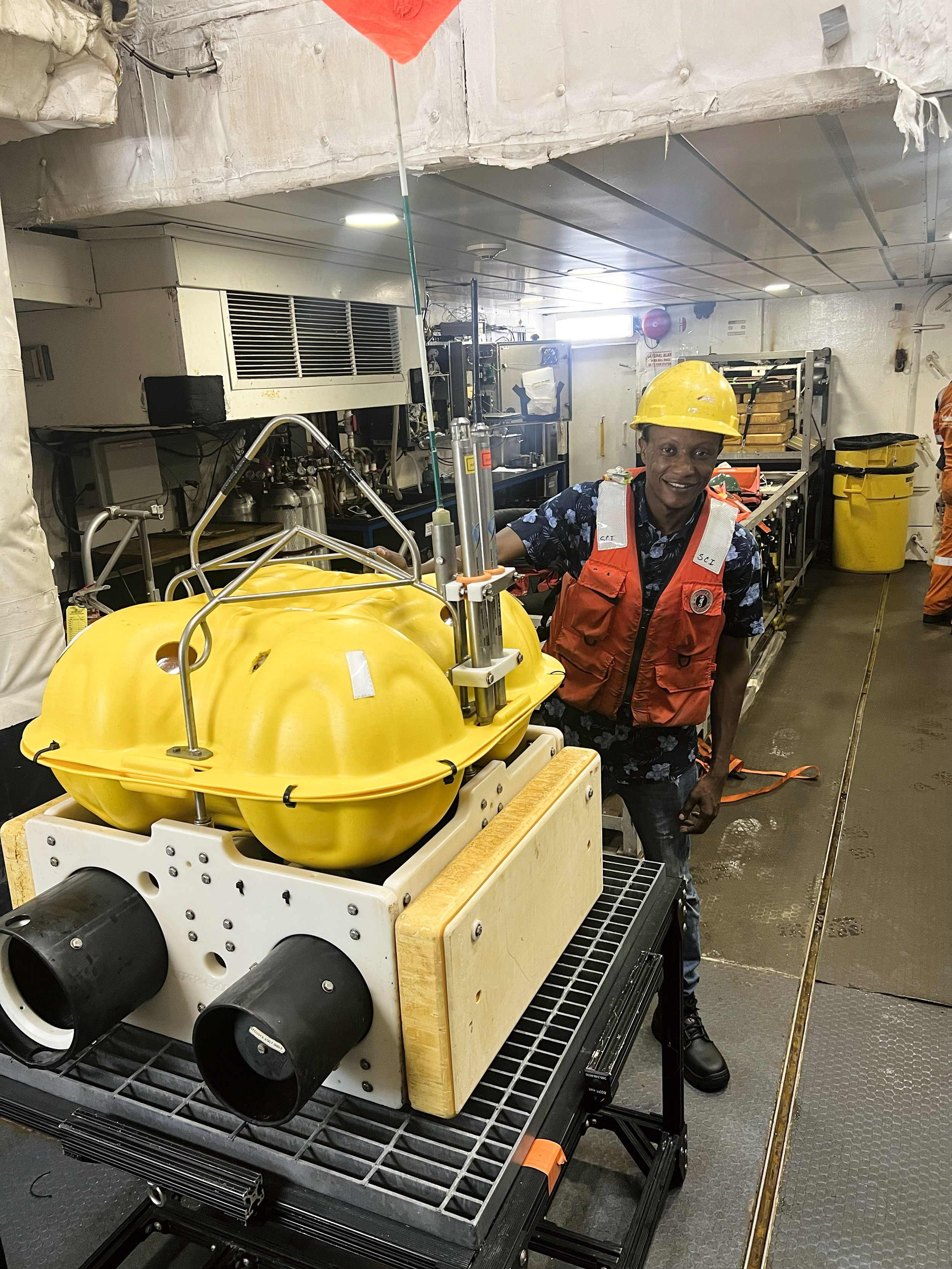
Tawfic, the author of this blog post, standing next to an OBS that was just recovered from the sea.
What is an OBS?
OBS, or Ocean Bottom Seismometers, are instruments used to record seismic signals at the seafloor. They are deployed at the bottom of the ocean to measure the natural or artificially induced seismic waves.
A brief overview:
Purpose: OBS are designed to record natural or artificially induced seismic waves. By studying these waves, scientists can learn about the Earth’s subsurface, such as the structure of the crust and the mantle beneath the oceans.
Components: An OBS typically includes a seismometer, which senses ground motion, and often a hydrophone, which detects pressure changes in the water column. There is data logger, an accurate clock, an acoustic release, and a lot of flotation material.
Deployment: These instruments are placed on the seafloor where they remain for a set period, recording data. After this period, they are retrieved, usually by sending an acoustic command that releases the OBS from the seafloor, allowing it to float to the surface.
Applications: OBS are used in various research areas, including tectonic studies, earthquake research, and hydrocarbon exploration.
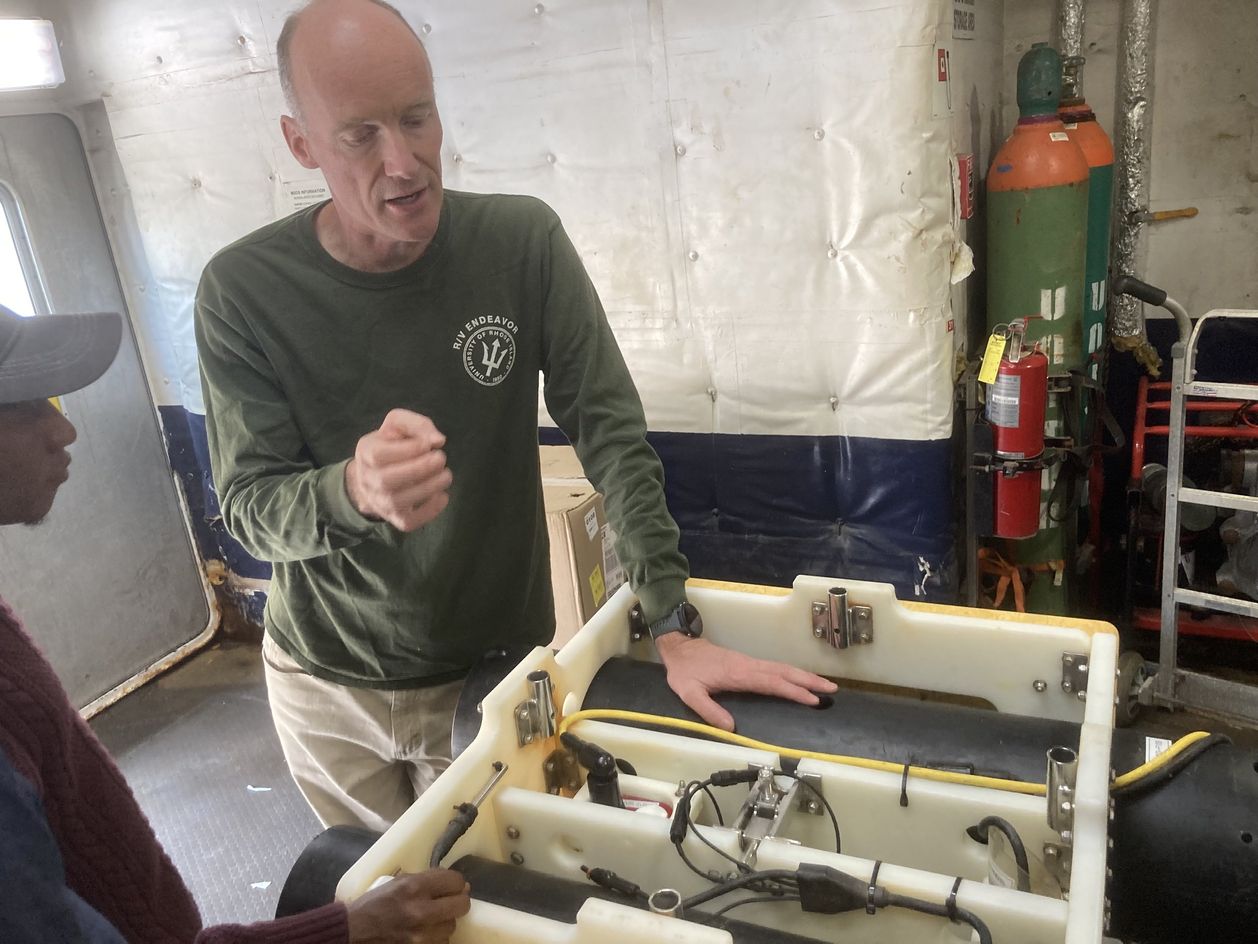
Harm is standing by a OBS and talking about its different components.
How does the OBS instrument work?
Components:
Seismometer: This is the heart of the OBS. It detects and measures the vibrations and movements in the Earth, translating them into electronic signals.
Hydrophone: This device measures pressure changes in the water column caused by seismic waves.
Data Logger: All the seismic data picked up by the seismometer and hydrophone are stored here.
Battery: The power source for the OBS, ensuring it can run for the duration of its deployment.
Acoustic Release System: This system allows the OBS to detach from its anchor and float back to the surface when the measurement period is over or when it is summoned.
Deployment:
OBS is placed on the seafloor, where it remains anchored. Once in place, it begins its recording session. As seismic waves (either from natural sources like earthquakes or artificial sources like air guns) travel through the Earth and water, they are detected by the OBS's seismometer and hydrophone.
Recording:
The seismometer records ground motion in three dimensions: vertical, north-south, and east-west. This helps in pinpointing the direction of the seismic wave source and understanding its characteristics.
The hydrophone captures pressure changes in the surrounding water. This is crucial for distinguishing between seismic waves traveling through the Earth and those traveling through the water.
Retrieval:
After its recording session, the OBS can be commanded to return to the surface. This is done by sending an acoustic signal, which triggers the acoustic release system.
The OBS detaches from its anchor and floats to the surface, usually with the help of flotation devices. Once retrieved, data can be downloaded from the data logger for analysis.
Analysis:
The recorded data are processed and analyzed by geophysicists and seismologists to interpret the subsurface structures and characteristics. By studying how seismic waves are refracted or reflected, scientists can infer information about the layers of the Earth's crust and mantle beneath the seafloor.
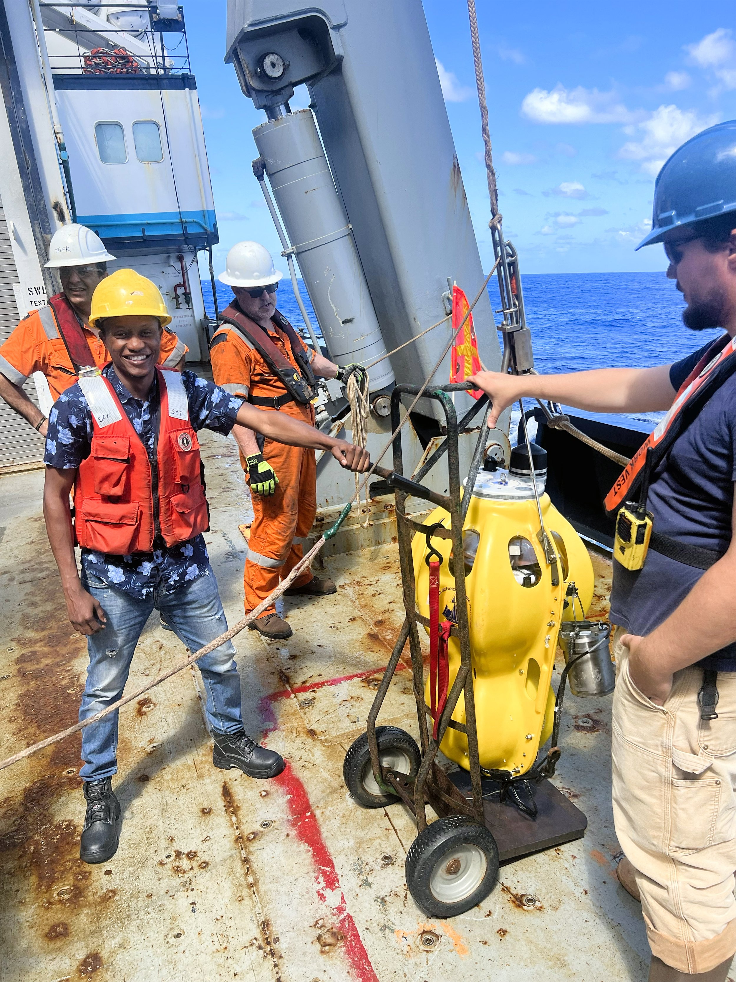
Tawfic is working on the deck. He is deploying OBS with (another)Tawfic, Riley, and Dan.
A step-by-step overview of how OBS data analysis works:
Data Retrieval:
Once the OBS is retrieved from the seafloor, data is downloaded from the instrument's internal storage.
Pre-processing:
This step involves cleaning up the data. Noise, such as that from ocean currents or marine life, is filtered out.
Timing corrections are applied if there are synchronization issues.
Instrument response is deconvolved to convert raw data into true ground motion or pressure changes.
Event Identification and Picking:
Seismic events, like earthquakes or artificial seismic sources, are identified in the continuous data stream.
Arrival times of seismic waves (P-waves and S-waves) are picked. This is crucial for determining the location and depth of seismic events and the structure of the subsurface.
Location Determination:
Using data from multiple OBS instruments and known wave speeds in different layers of the Earth, the source location of seismic events can be triangulated.
Seismic Reflection and Refraction Analysis:
OBS records both reflected and refracted seismic waves.
Reflected waves can help map interfaces between different geological layers. This is particularly useful in hydrocarbon exploration.
Refracted waves provide information about the layers' properties through which they have traveled, helping determine layer depths and velocity structures.
Seismic Ambient Noise Analysis:
OBS are very good in recording continues seismic data which allows the extraction of Empirical Green’s Function through a cross correlation. The data from the cross correlation helps in developing seismic tomography images of the crust and the mantle.
Tomography:
Using data from instruments, a 3D image of the subsurface can be created. This process, similar to a CT scan in medicine, produces a detailed image of subsurface velocities, revealing structures like magma chambers or subduction zones.
Full Waveform Inversion (FWI):
An advanced technique that uses the entire seismic waveform (not just arrival times) to iteratively refine a model of the subsurface. It provides high-resolution models of subsurface properties but requires substantial computational resources.
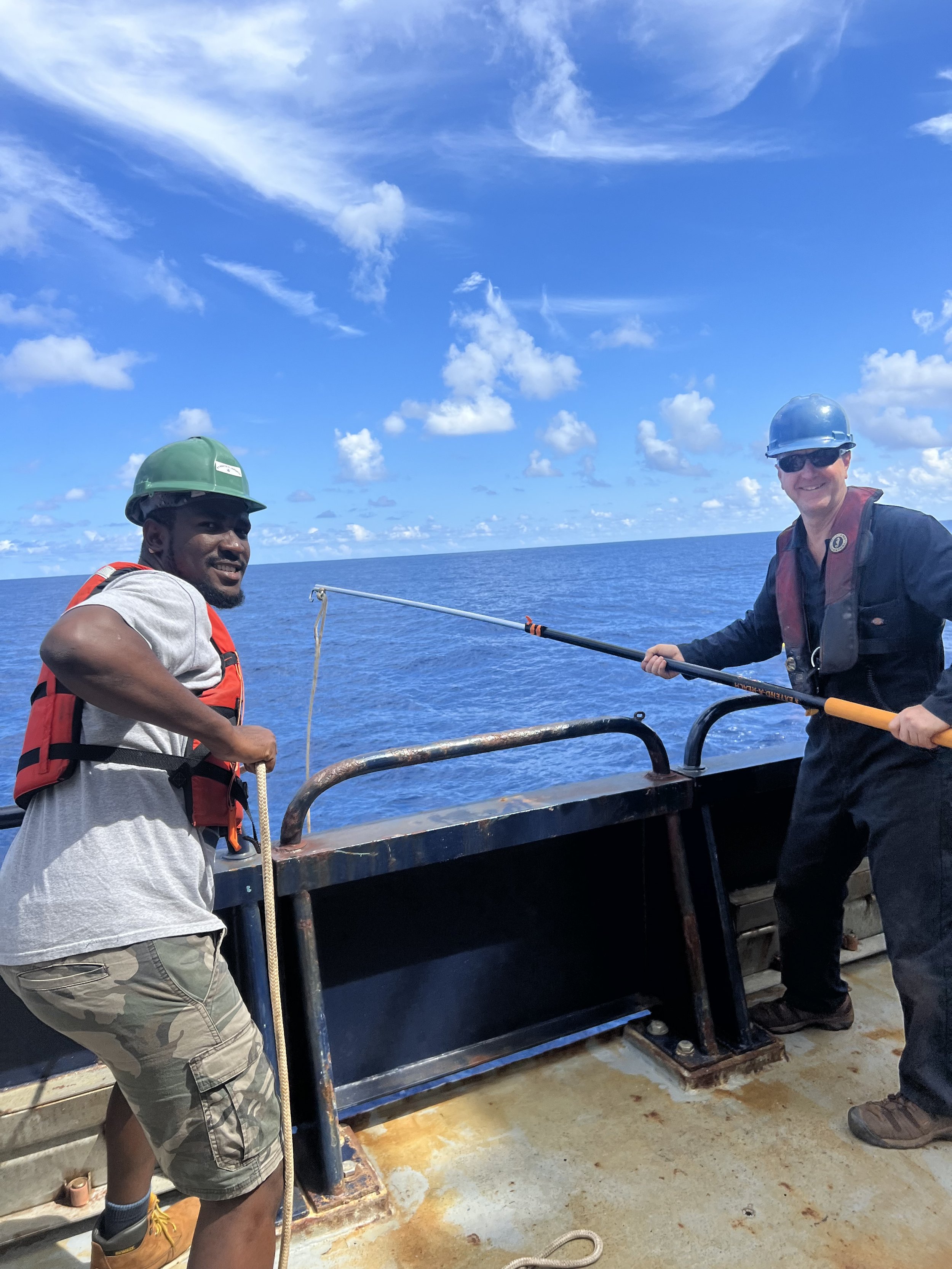
Victor and Klay are grabbing OBS from the sea.
Difference from MCS (Multichannel Seismic):
Both Ocean Bottom Seismometers (OBS) and Multichannel Seismic (MCS) are valuable tools in the domain of marine geophysics, but they serve different purposes and have distinct operational principles. Here is a comparison to highlight the differences:
Nature of Instruments:
OBS: These are stationary instruments deployed on the seafloor. They consist of seismometers and hydrophones that capture seismic waves as they pass through or are reflected off subsurface structures.
MCS: This is a towed system, often used from a ship. An MCS setup includes a series of hydrophones (or geophones) strung out on long cables known as streamers. These streamers can be several kilometers long.
Data Acquisition:
OBS: Being on the ocean floor, OBS can record both the direct waves from a seismic source and the waves reflected from the subsurface layers. They can capture data over extended periods (from days to months).
MCS: A ship tows both the seismic source (usually air guns) and the streamers. The source emits a signal, and the returning reflected waves are captured by the hydrophones on the streamers. This method primarily focuses on the reflected waves.
Spatial Coverage:
OBS: OBS provides point measurements. A network of OBSs can be spread out over a region to capture data simultaneously, but each instrument measures the seismic waves at its specific location.
MCS: It provides a continuous profile of the subsurface along the ship’s track.
Data Perspective:
OBS: Offers a broad bandwidth of data due to its stationary nature and can record both wide-angle reflections and refractions.
MCS: Focuses mostly on near-vertical reflections, giving detailed information about subsurface layering.
Applications:
OBS: Used for detailed seismic studies, tectonic investigations, earthquake research, and more. The combination of reflection and refraction data can give insights into deeper geological structures.
MCS: Primarily used in hydrocarbon exploration and research to understand sedimentary layering and potential reservoir structures. It is ideal for creating detailed subsurface images.
Operational Complexity:
OBS: Requires deployment and retrieval operations, which might be logistically challenging in deep waters or areas with complex seafloor topography.
MCS: While it can cover large areas quickly, MCS operations need a vessel continuously moving with the towed equipment, making it potentially more vulnerable to weather conditions and requiring consistent monitoring.

Dan and Klay are moving OBS to the cart. Photo by Victor.
Advantages and Limitations of OBS data:
Advantages:
Broad Bandwidth: OBS units can record a wide frequency range, from high-frequency seismic events to low-frequency tremors, providing a detailed understanding of various geophysical processes.
Reduced Noise: Being on the ocean floor shields OBS from surface noise like waves, tides, and human-made disturbances, resulting in cleaner data.
Flexibility in Study Design: OBS can be deployed in locations where traditional towed seismic methods might not be suitable, such as around seafloor infrastructures, sensitive marine areas, or very deep waters.
Both Reflection and Refraction Data: OBS captures both reflected and refracted seismic waves, offering a richer dataset to interpret subsurface structures.
Passive Seismic Monitoring: Besides active sources (like air guns), OBS can monitor and record natural seismic events such as earthquakes or volcanic activity, making them valuable for tectonic and geodynamic studies and it is also good in recording continues seismic noise data which is useful for ambient noise method.
Better Angle Coverage: Due to their stationary position on the seafloor, OBS can record wide-angle reflections and refractions, which are valuable for studying deep crustal and mantle structures.

After the OBS is recovered, Dan is checking the “health status” of the OBS to make sure the seismic data is reliable.
Limitations:
Deployment & Retrieval Challenges: The logistics of deploying and retrieving OBS units can be complex, especially in deep or rugged seafloor terrains.
Data Volume: Compared to towed seismic methods that continuously record data over vast areas, the point measurements of OBS might require more instruments for extensive coverage.
Instrument Loss: There’s always a risk that some OBS units might not be retrieved due to equipment malfunction, seafloor hazards, or other unforeseen issues.
Battery Life: The OBS units are battery-powered, so their operational time is limited. While they can often work for weeks to months, long-term monitoring might require periodic retrieval and redeployment.
Potential for Seafloor Noise: While OBS is shielded from surface noise, they might still pick up seafloor disturbances, such as from currents, gravitational waves of the sea, marine life, or sediment shifts.
Data Transfer: Data can only be accessed once the OBS is retrieved, unlike some towed systems or cabled observatories that provide real-time or near-real-time data access.

The recovering also happens at night. Dan is trying to crab one of them from the ocean.
Written by Tawfic Yakubu
Blog edited by Ranpeng Li